
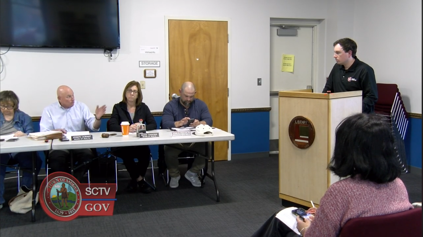
Saugus Board of Health Opens 60-Day Question Period on Ash Landfill Closure
At its June 1st meeting, the Saugus Board of Health took another step toward getting clearer answers on the future of the WIN Waste ash landfill. After months of questions about closure, remaining capacity, ash placement, cover material, long-term monitoring, and MassDEP oversight, the Board voted to open a 60-day period for questions from the Board, the public, and other interested communities.

Ruth Bancroft Law: The Lynn-Born Aviator Who Took Flight Over Saugus
On the anniversary of Ruth Law’s birth, we are glad to remember a remarkable Lynn-born woman whose achievements reached far beyond New England, but whose first chapters were written right here.
Saugus Deserves a Real Landfill Closure Update
The Board of Health asked for landfill closure updates. If the issue is on the agenda, WinWaste should come prepared with a clear status report or send someone who can provide one.

What We Learned in RMC’s First Public Webinar on the Abandoned I-95 Embankment
On Tuesday evening, more than fifty people joined Rumney Marsh Conservancy’s first public webinar for a discussion that was, in many ways, about far more than a remnant highway project.
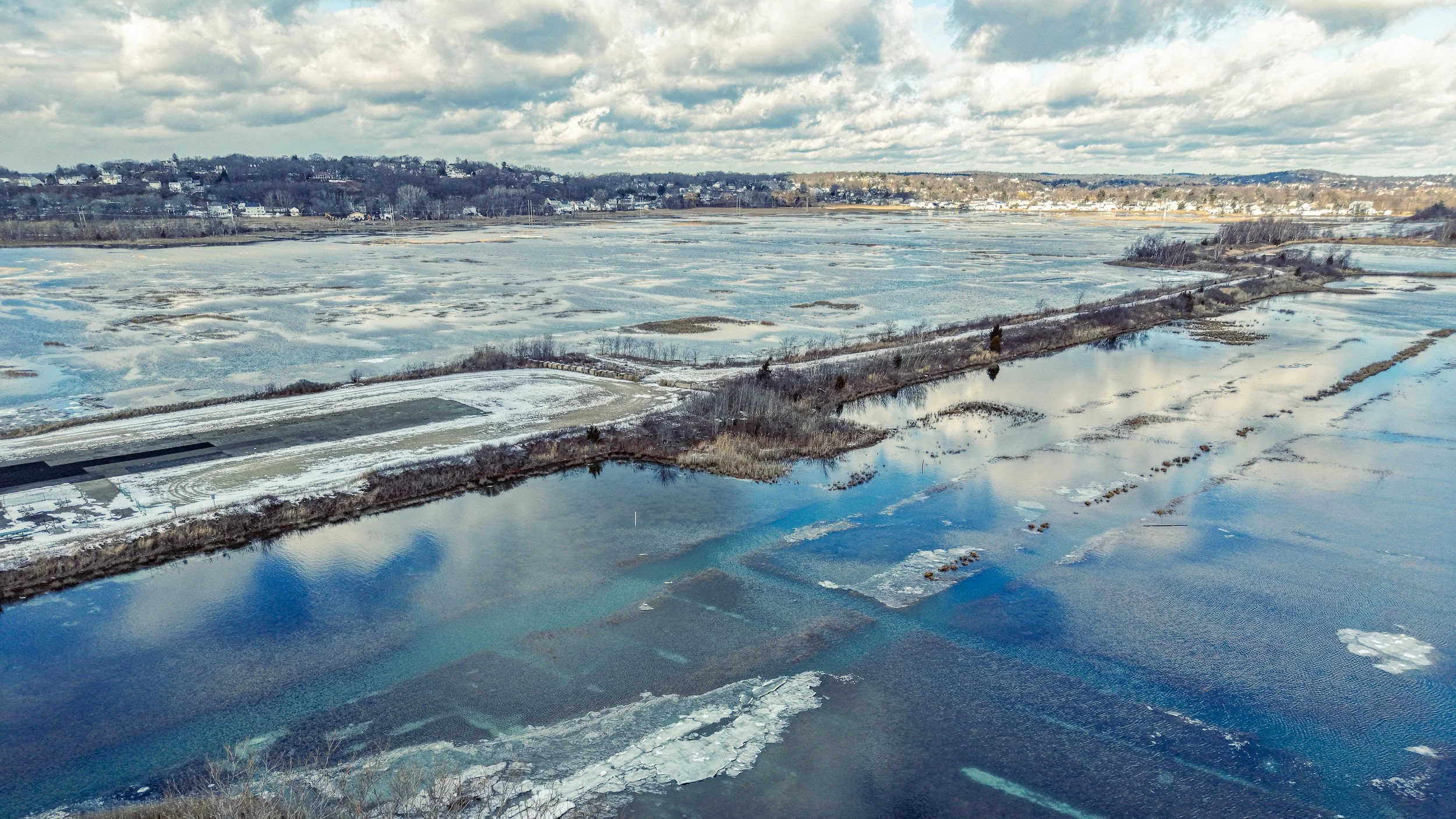
Rumney Marsh Has a Hydrology Problem
Restoration is underway at Rumney Marsh, but without restoring tidal flow, there is a limit to what these efforts can achieve.
At the Edge of Rumney Marsh, a Clean Energy Project Raises Familiar Questions About Place and Burden
A new energy storage facility in Revere highlights a familiar pattern: infrastructure that serves the region continues to be concentrated in communities already carrying a disproportionate share of the burden.
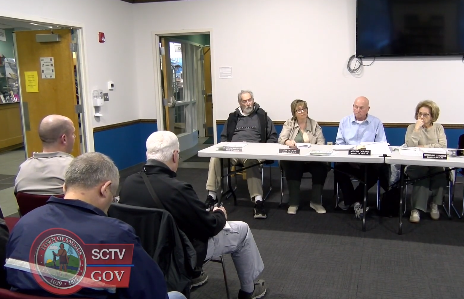
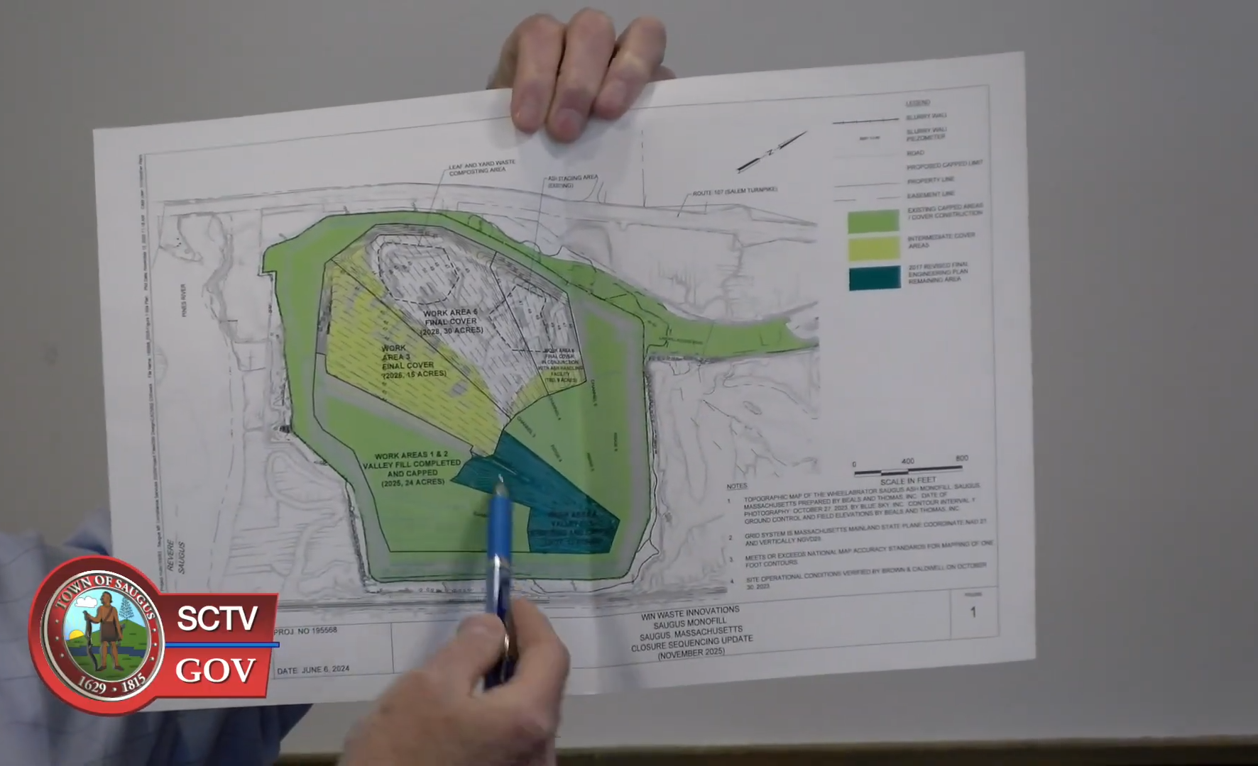
April 6th Saugus Board of Health Meeting: Where Things Stand
The April 6th, 2026 Saugus Board of Health meeting offered a useful snapshot of where things stand with the WIN Waste facility and the ash landfill, and just as importantly, where questions are starting to sharpen.
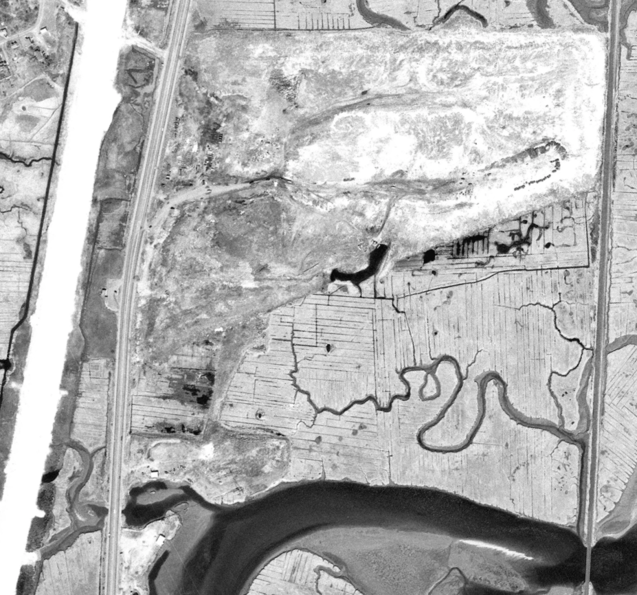
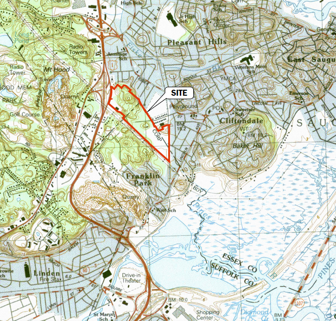
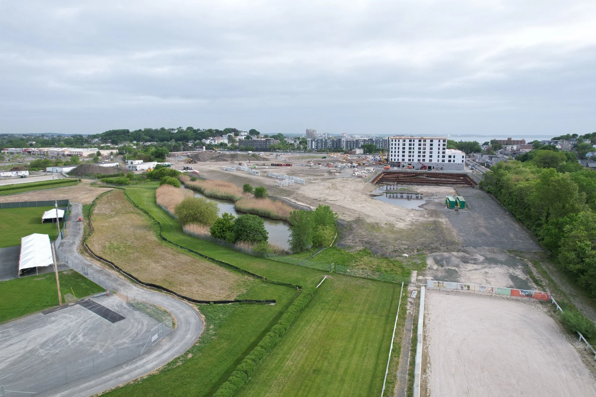
How a Marsh Became Home to an Ash Landfill
The landfill complex located adjacent to Rumney Marsh in Saugus, Massachusetts has evolved through several distinct phases over the past seventy years. What exists today as the Saugus Ash Monofill is not the product of a single landfill project, but rather the result of several generations of waste disposal practices layered onto the same landscape.
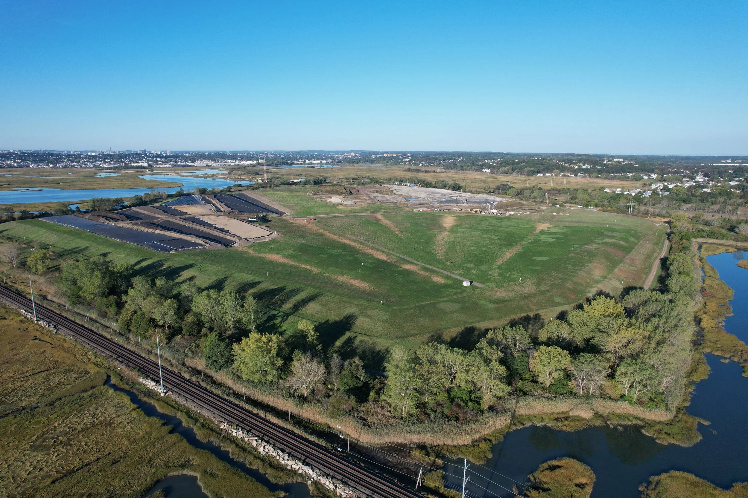
Landfill Closure Clock Now on Monthly Agenda
At Monday night’s Saugus Board of Health meeting, the Ash Landfill Closure Committee asked the Board to take a more active and structured role in planning for closure of the ash monofill located within the Rumney Marshes Area of Critical Environmental Concern.
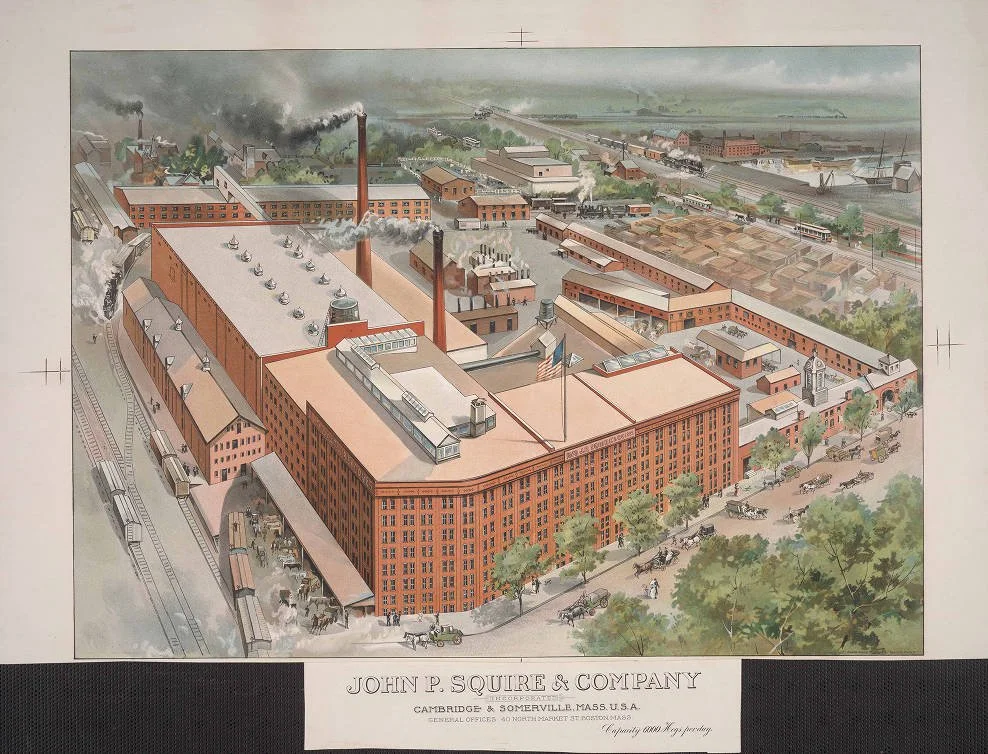
Who was J.P. Squire?
John P. Squire was one of the most influential pork packers in 19th century New England. To support his massive operation, Squire owned significant land in what is now West Revere, right along the edge of the Rumney Marsh.
Sales Creek: An Overlooked Waterway of the Rumney Marsh ACEC
Most people have driven past Suffolk Downs a hundred times without realizing there is an active tidal creek running straight through the site. That creek is called Sales Creek. And it plays a bigger role in the Rumney Marsh and Belle Isle ecosystem than most people realize.

Starling Invasion!
No, this is not a scene from an Alfred Hitchcock movie. This is Rumney Marsh on 11/16, with hundreds of European Starlings gathering in the sky in one of their classic winter flock displays.

What Is LIDAR and Why Does It Matter for Rumney Marsh?
Unlike regular aerial photography, LIDAR can pick up extremely small changes in elevation. It can read through vegetation. It can reveal hidden features that the eye cannot see. This makes it an incredibly powerful tool for studying salt marshes, which depend on subtle elevation differences for healthy tidal flow and habitat.

Aurora over Rumney Marsh
We apologize for the blurry photo, but long-exposure photography from 100 feet in 30+ knot winds isn't easy!

Pioneer Aviators trained at Rumney Marsh
Many people know the old Franklin Park site in Saugus as a racetrack. Before the roar of stock cars, it was a horse track, and for one short and remarkable moment in 1912, it became something very different.

Marsh erosion: existing healthy habitats are at risk.
What happens when an abandoned highway embankment pinches a living tidal system? The water finds another path. This temporary channel is widening and eroding the marsh. It is one more sign that Rumney Marsh needs full, natural tidal flow to stay healthy.

What's that green slime?
It's not paint or pollution. It's a natural salt marsh algae that grows where sunlight, tides, and nutrients meet. In healthy amounts it's part of the marsh food web. When it grows too thick, it can signal extra nutrients upstream and can stress marsh plants.

Map of Rumney Marsh ACEC
Here is a new illustrated map of Rumney Marsh, designed to help you find trails, parking, and places to explore. Save it, share it, and enjoy your time in the marsh!

Why the Saugus Incinerator Buys "Offsets" Instead of Cleaning Up
Under Massachusetts DEP rules, certain industrial facilities can stay in compliance by buying pollution “offsets” instead of directly reducing their own emissions.

Ever wonder how exactly Rumney acts as a giant natural water filter?
Ever wonder what that “marsh smell” is, or how exactly Rumney acts as a giant natural water filter?