Rumney Marsh:
Start Here.
Rumney Marsh is one of the most important remaining salt marsh systems north of Boston. It is also one of the most altered, misunderstood, and overlooked.

What is Rumney Marsh?
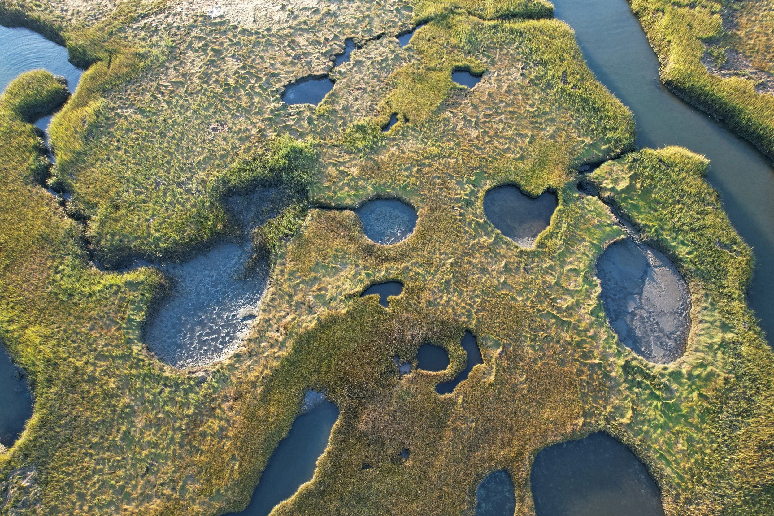
Rumney Marsh is a coastal salt marsh system located just north of Boston, shaped by the Saugus River, Pines River, tidal creeks, mudflats, and upland edges.
EPA has described Rumney Marsh as approximately 2,274 acres of coastal salt marsh. It sits in and around Revere, Saugus, and Lynn, and remains an important place for wildlife, flood storage, public access, education, and restoration.
In 1988, Rumney Marsh was designated an Area of Critical Environmental Concern (ACEC) by the Commonwealth of Massachusetts.
In one sentence: Rumney Marsh is a living tidal landscape where rivers, salt water, wildlife, infrastructure, and community history all meet.
Why Rumney Marsh matters.
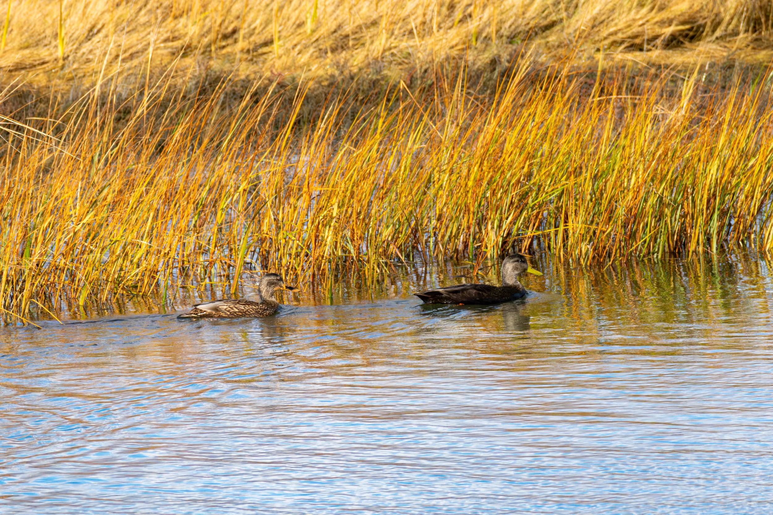
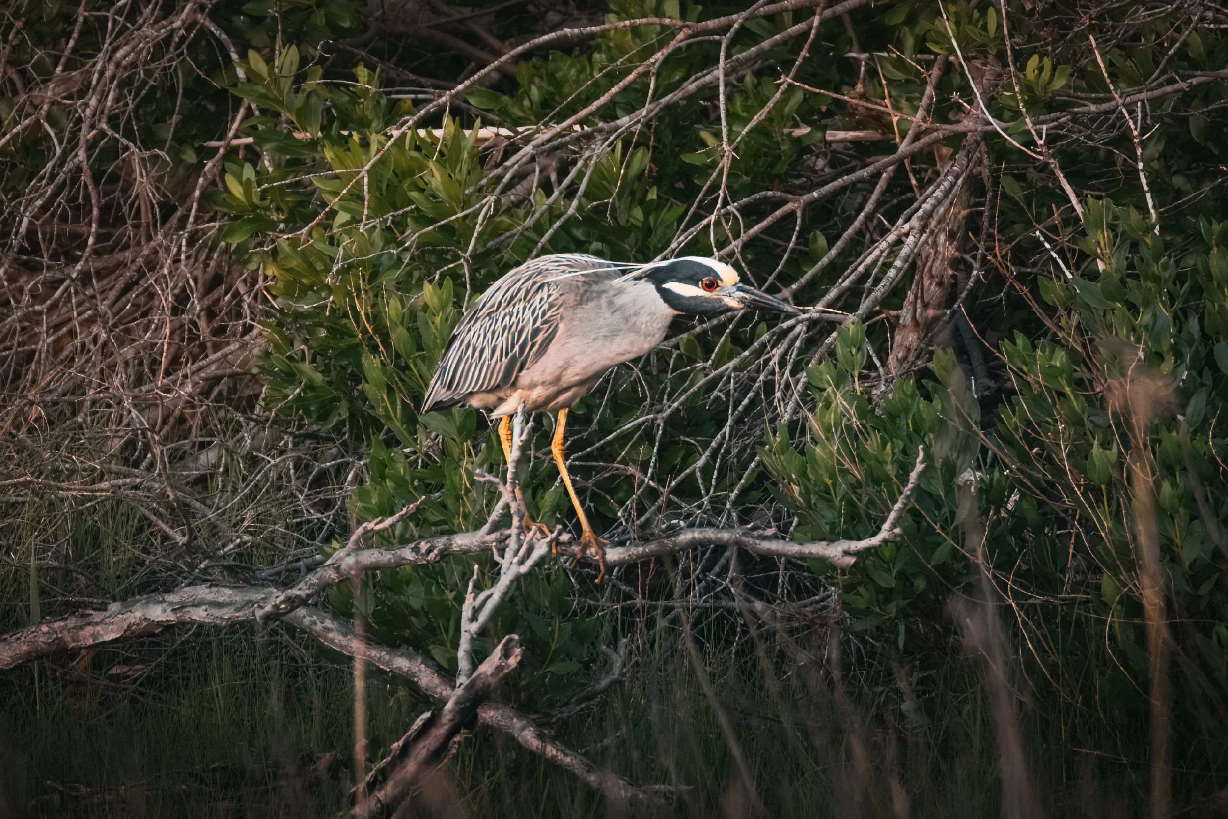
Wildlife Habitat
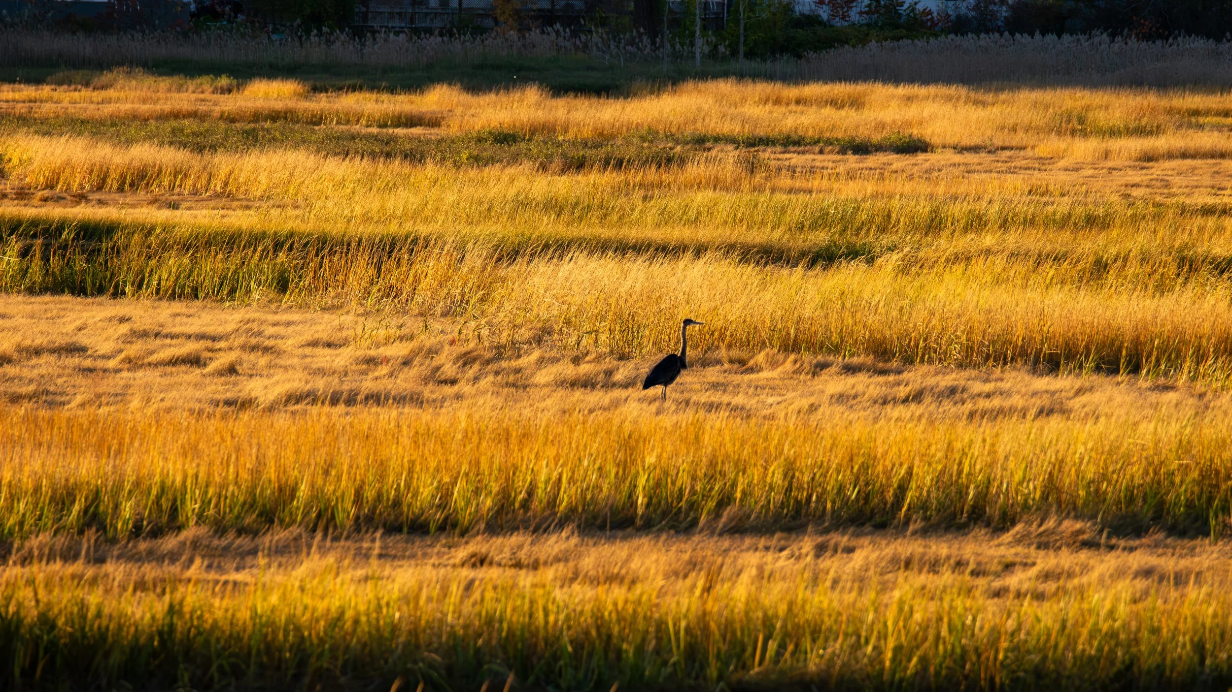
Rumney Marsh supports birds, fish, shellfish, salt marsh plants, and other wildlife that depend on tidal wetlands. Some species are adapted to salt marshes and cannot persist without them.
Flood Storage and Resilience
Healthy marshes absorb water, slow storm surge, and provide space for tides and floodwaters to move.
Public Open Space
Trails, river views, bird walks, and educational programs help people understand the landscape in their own backyard.
Restoration Potential
Many of the marsh’s problems are the result of past decisions, which means many can be documented, studied, and improved.
What Happened Here?
How Rumney Marsh became what it is today
Before major alteration
Long before modern roads, rail lines, landfills, and the abandoned I-95 embankment, Rumney Marsh was part of a larger tidal system of rivers, creeks, salt marsh, mudflats, upland edges, shellfish beds, and coastal routes. The Revere-area historical survey describes this as a coastal resource area used by Native groups living on the northern edge of the Boston Basin, likely associated with the Pawtucket/Penacook. It was a place of fish, shellfish, marsh plants, hunting, gathering, movement, and trade.
Mid-century dumping and industrial use
By the mid-20th century, parts of the marsh and its edges were treated less like habitat and more like disposal space. Areas around the Pines River and Salem Turnpike were used for municipal, industrial, and mixed solid waste. At the Dewey Daggett landfill area, waste was placed along the marsh edge and later documented at depths of roughly 15 to 20 feet below grade. Some of that waste was left exposed to erosion along the Pines River and Rumney Marsh ACEC.
European settlement and salt hay farming
European settlement changed the relationship between people and the marsh. What is now Revere was once known as Rumney Marsh and was acquired by Boston in the 1600s. Early colonial farms, roads, mills, landing places, and meeting houses developed around the marsh edge.
For generations, the marsh was treated as working land. Salt hay was cut and used for farms, livestock, bedding, and packing material, while nearby uplands were divided into farms and connected to Boston, Chelsea, Lynn, Salem, and surrounding communities.
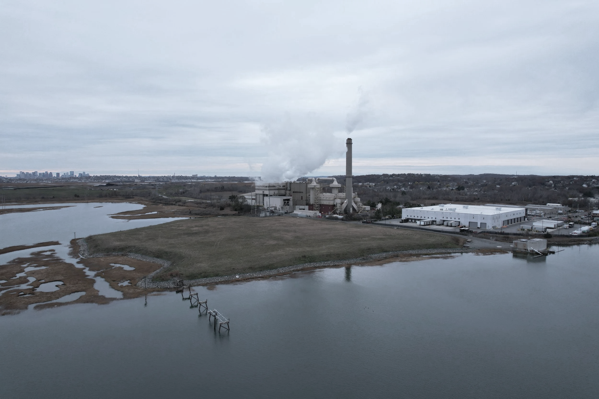
Waste-to-energy and ash disposal
In the 1970s, a waste-to-energy facility was constructed within Rumney Marsh, on land already shaped by earlier mixed-waste disposal. Ash disposal continued on top of those older waste areas, adding another layer to the site’s complicated history.
The result is not just an industrial facility near the marsh, but a long-running disposal area inside the marsh itself, tied to questions about ash management, landfill capacity, air emissions, truck traffic, monitoring, tidal restriction, and long-term responsibility.
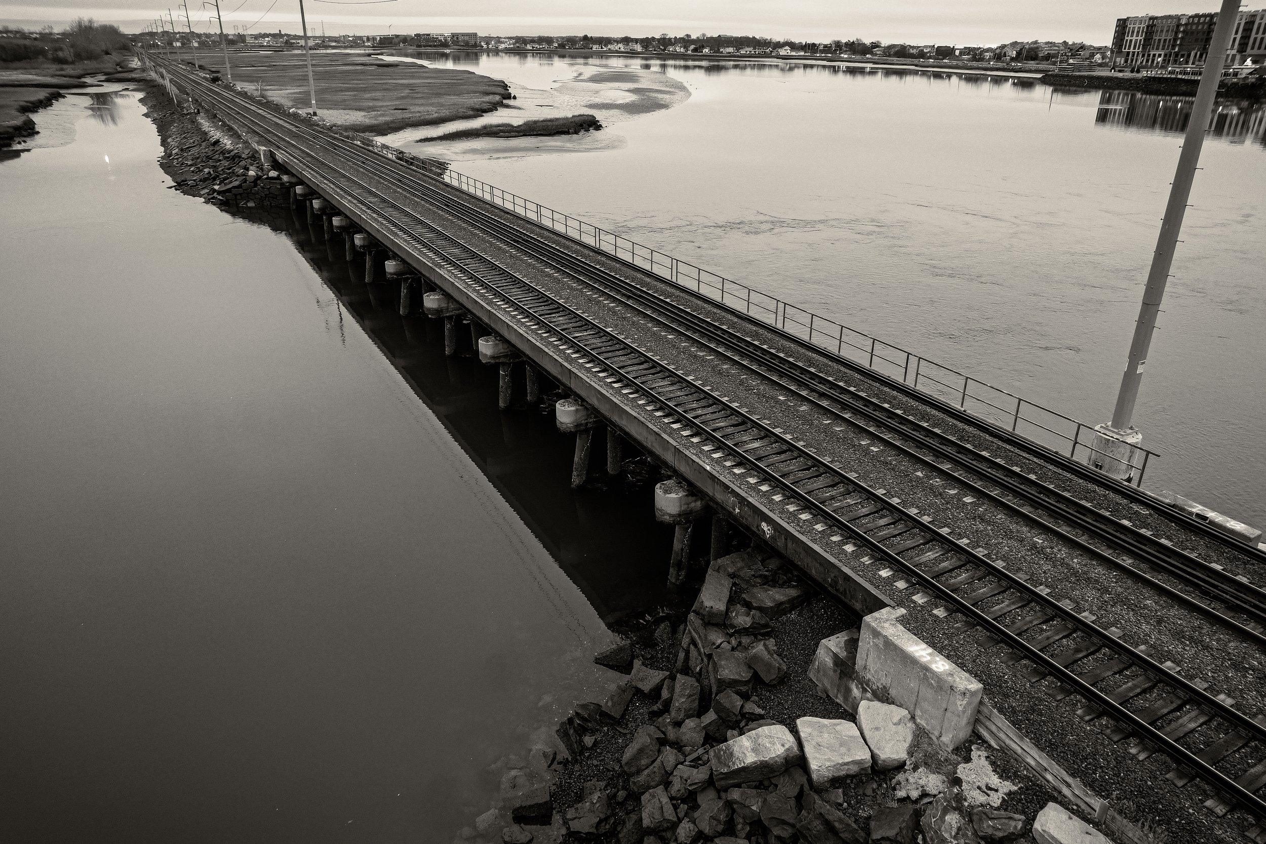
Turnpikes, railroads, and transportation corridors
In the early 1800s, the Salem Turnpike strengthened the transportation link between Boston and Salem. A few decades later, the Eastern Railroad crossed the tidemarsh, adding another major corridor through the landscape. Roads, bridges, rail lines, drainage systems, and later utilities all changed how people moved through the marsh, and how water moved through it.
The abandoned I-95 embankment
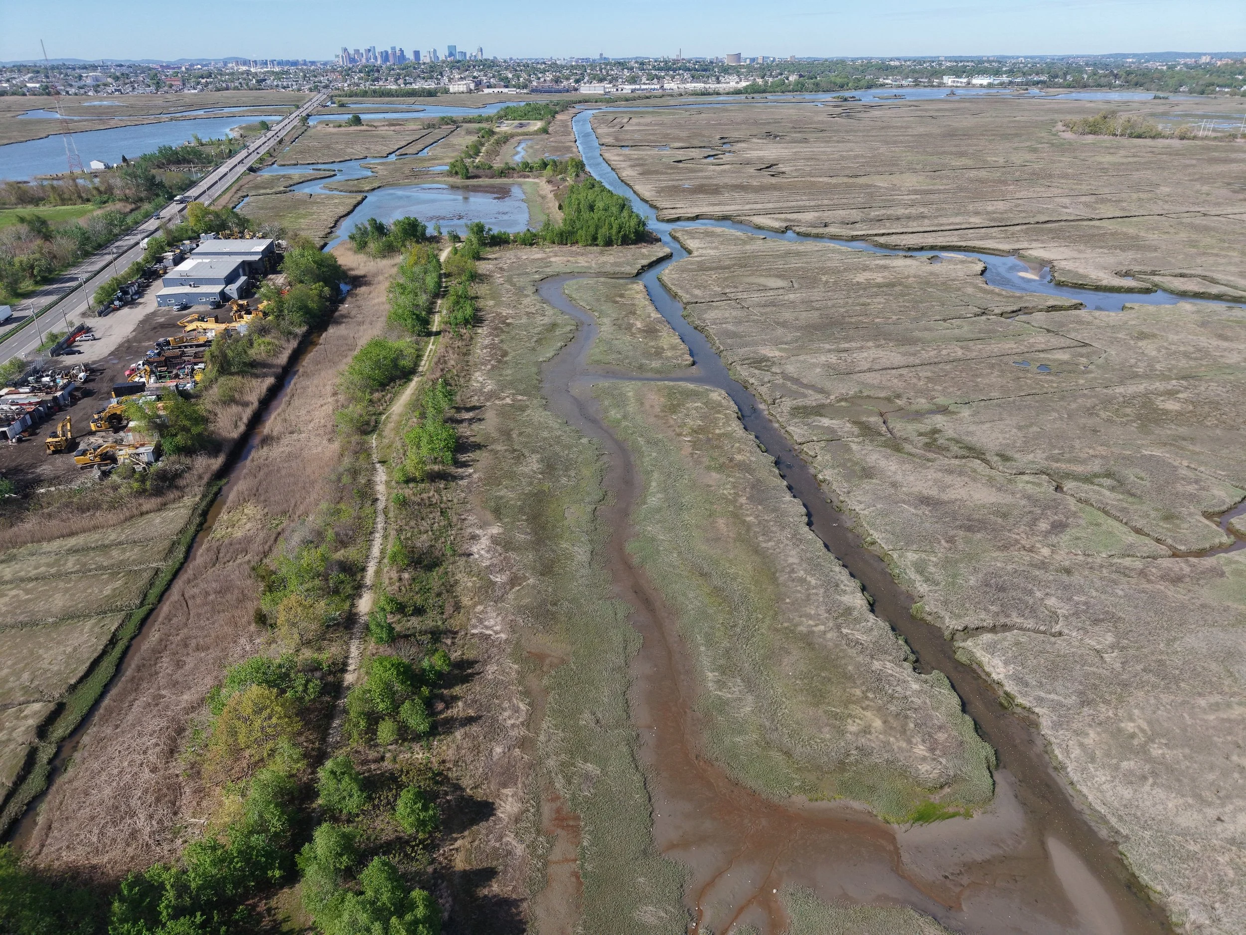
At the same time, the abandoned I-95 project placed a massive highway embankment through Rumney Marsh. Between 1967 and 1969, approximately 120 acres of marsh were filled with about 6 million cubic yards of material for a highway extension that was never completed.
The remaining embankment still affects hydrology, habitat, public access, erosion, restoration planning, and how people perceive the marsh today.
Today
Rumney Marsh is still ecologically valuable, but it is also constrained by the decisions layered onto it over centuries. It remains a living salt marsh system, but one shaped by Indigenous history, colonial farming, salt haying, roads, rail lines, dumping, ash disposal, tide gates, culverts, stormwater, and the abandoned I-95 embankment. Understanding those layers is the first step toward protecting the marsh and thinking seriously about its future.
The Main Issues.
The issues RMC is watching
Abandoned I-95 Embankment
A major fill corridor still cuts through the marsh and affects water movement, habitat, and restoration opportunities.
Stormwater & Water Quality
Stormwater outfalls, urban runoff, and combined sewer issues in nearby waters affect the broader coastal system.
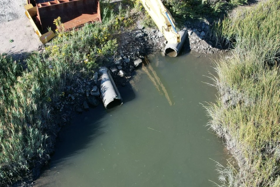
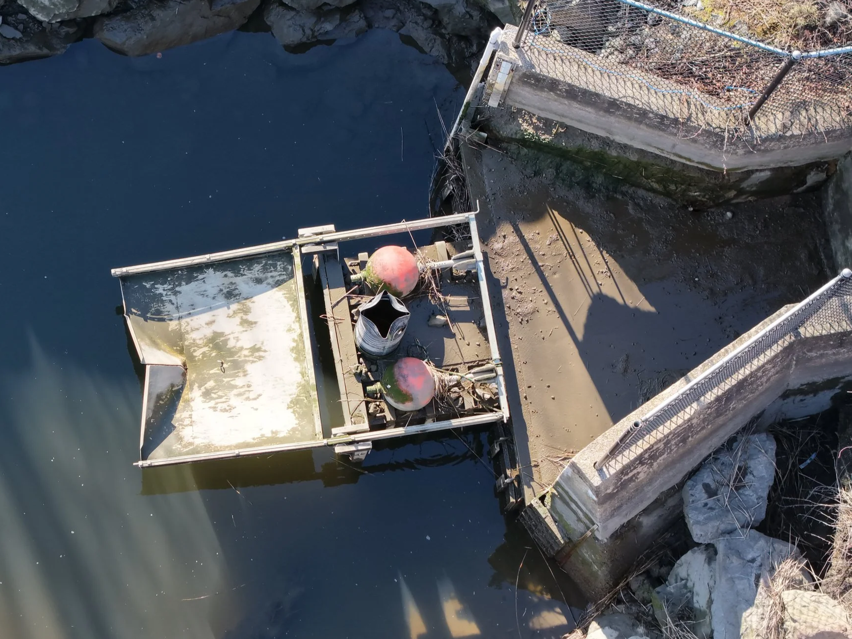
Tide Gates and Culverts
Undersized or aging structures can restrict tidal exchange and alter marsh conditions.
Wildlife Disturbance
Human activity, noise, unauthorized uses, and poor stewardship can affect sensitive habitat.
Legacy Land Use
Past fill, ash disposal, industrial activity, roads, rail lines, and utility corridors continue to shape the marsh.

Public Understanding
Many people know the the view, but not the history, hydrology, or restoration challenges behind what they see.
What Rumney Marsh Conservancy does.
Education
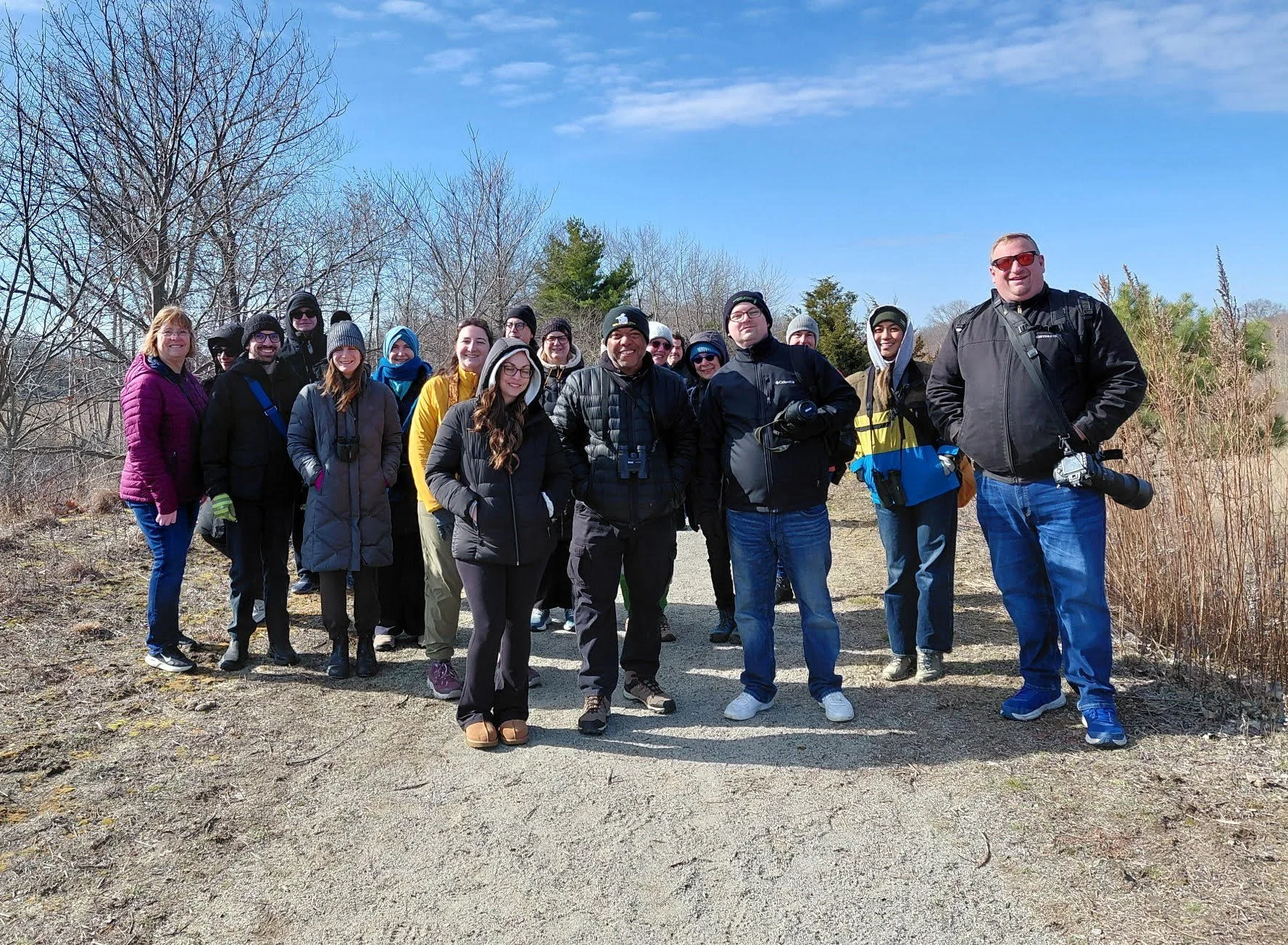
We help the public understand Rumney Marsh through webinars, walks, articles, videos, and accessible explanations.
Stewardship
We support responsible public use, restoration conversations, and long-term care for the marsh.
Documentation
We document field conditions, infrastructure concerns, wildlife observations, public access issues, and changes over time.
Advocacy
We correspond with agencies, review public records, comment on projects, and push for thoughtful stewardship.
RMC is a volunteer-led 501(c)(3) public charity.
Featured Resource
Watch: RMC Webinar on Tidally Restricted Marshes
A recorded presentation explaining how tidally restricted marshes can be restored while maintaining flood protection for nearby neighborhoods.
Start Learning Here.
Additional Links
Read about tide gates and culverts
Visiting Rumney Marsh.
(Rumney Marsh has never really had a front door)
Depending on your generation, your first experience of the marsh may have been jumping from Dizzy Bridge and letting the current pull you in or out before doing it all over again.
You may have fished from the Route 107 bridges, paddled the Pines River, watched the sun come up over the Seaplane Basin, raced canoes during Row Row Row in Revere, or known the marsh from Linden, North Revere, Saugus, or the riverbanks in between.
Some people knew it through less formal uses too, from informal trails to dirt bikes in places they probably should not have been.
That is part of what makes Rumney Marsh different from a traditional park. It was never introduced to the public through a single visitor center, gateway, or interpretive path. People found their own way in through bridges, neighborhoods, boat ramps, fishing spots, industrial edges, and memory.
Today, the DCR trail on the abandoned I-95 embankment gives visitors one of the clearest ways to walk into the marsh and see it up close. This is a real opportunity, but it also creates a strange juxtaposition. The trail sits on a highway embankment that was never supposed to become the final condition of the marsh. For decades, this area has remained in a kind of interim management condition, without the broader restoration planning that was long contemplated for the abandoned highway corridor. It can be a beautiful place to walk, but it is also a reminder of the work still ahead.
With that context in mind, here are several ways to experience Rumney Marsh today.
DCR Rumney Marsh Trail
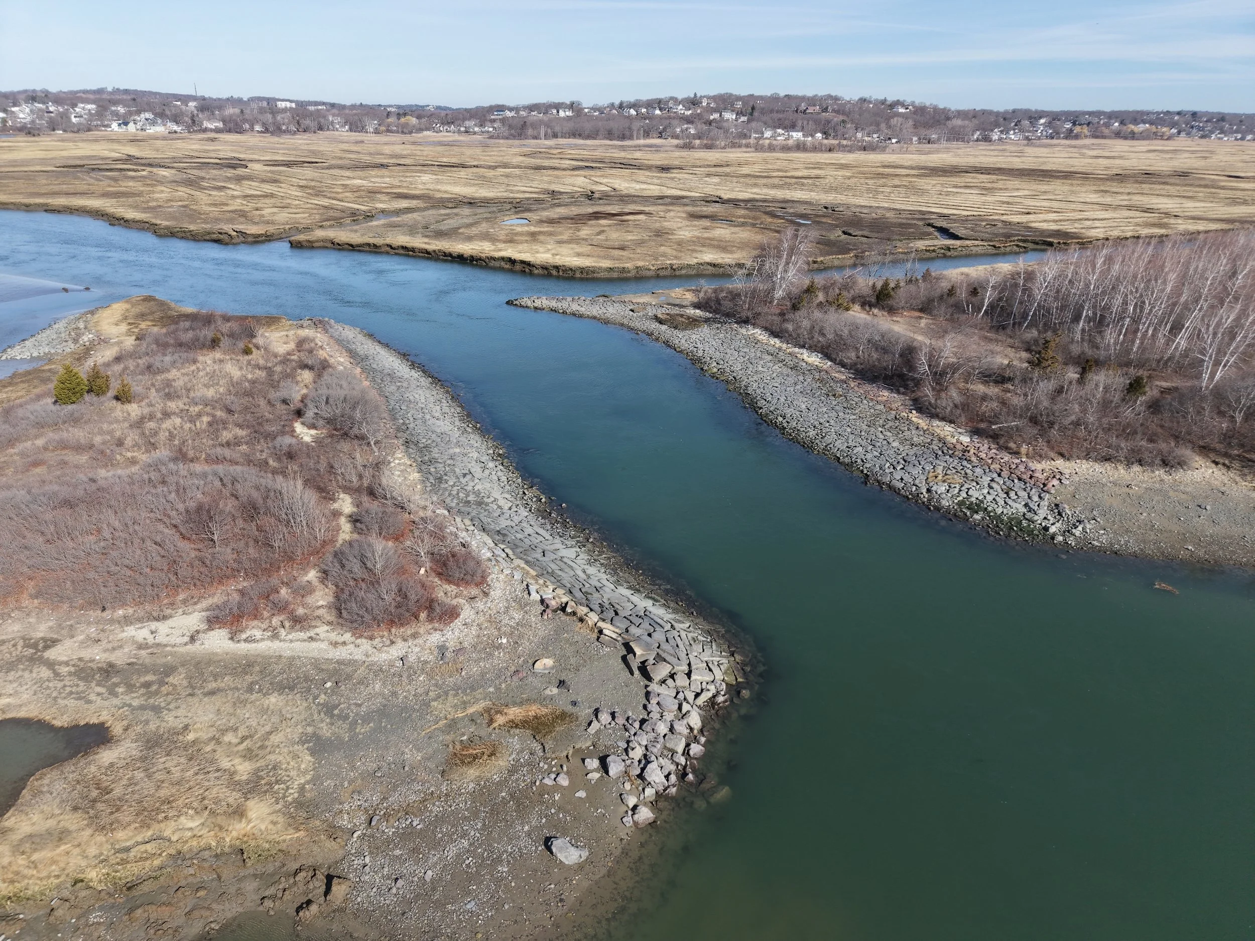
The DCR trail can be accessed from parking areas at Bristow Street and Ballard Street in Saugus. This is one of the best ways to see the marsh on foot. The trail provides views of the tidally restricted Ballard Street marsh, several completed mitigation and restoration areas, and the armored channel where the Pines River crossing restricts flow and drainage across the marsh.
This is a beautiful walk, especially for birding, photography, and understanding the scale of the marsh. Just do not forget the context.
The trail exists because a highway project was abandoned, not because the embankment is the marsh’s natural condition. Enjoy the view, but understand what you’re standing on.
Northern Strand Trail
The Northern Strand Trail, also known as Bike to the Sea, offers another excellent way to experience Rumney Marsh. The section between Linden Square, Revere, and Saugus includes views across the Seaplane Basin and surrounding marsh. It can be a great place for birding, walking, biking, or catching sunrise and sunset next to the water.
Farther north and east, between Saugus and Lynn, the trail parallels parts of the Saugus River landscape.
The Saugus River marshes are part of the larger Rumney Marshes system, and this section gives visitors a different view of the estuary beyond the abandoned I-95 embankment.
Route 107 Bridges
The Route 107 bridges between Revere and Saugus are one of the most familiar ways people experience Rumney Marsh. For generations, this has been a fishing spot, a place to watch the tide move through the rivers, and a good vantage point for photography, birding, sunrise, sunset, and views across the marsh.
There is public parking just beyond the third bridge on Route 107 northbound, with sidewalk access back toward the bridges. The bridges include small jut-outs often used by anglers, with views of the Pines River, Saugus River, tidal channels, marsh edges, and working waterfront activity.
Please use the area carefully. This is an active road corridor, not a park trail. Stay on the sidewalk or safe public areas, watch traffic, and do not climb over railings or enter restricted areas.
If you fish here, follow all Massachusetts recreational fishing rules, including permit, size, season, and catch limits. Anglers age 16 and older generally need a Massachusetts recreational saltwater fishing permit when fishing in salt water, and current recreational saltwater limits should be checked before keeping any fish. Before eating fish caught locally, review Massachusetts fish consumption guidance and advisories, especially for urban rivers and estuaries.
Fishing line, hooks, bait containers, and plastic packaging should never be left behind. Monofilament line can entangle birds, fish, turtles, and other wildlife. Cut tangled line into small pieces and dispose of it securely in the trash, or use a fishing line recycling container where one is available. Pack out everything you bring in.
Jacob’s Park
Jacob’s Park in Revere is an underdeveloped neighborhood resource near the Diamond Creeks. With a good pair of binoculars, it can be a rewarding place to look for osprey nesting platforms, salt marsh sparrows, and other marsh wildlife. This is not a polished nature center, but that’s part of the point. Rumney Marsh is often experienced from small neighborhood edges like this. There is no designated parking area. Please respect our neighbors.
Gibson Park
Gibson Park in Revere sits near the Pines River and is currently part of a larger resiliency and recreation planning effort. The area has historically served as neighborhood recreation space, and future improvements are expected to better connect public use, flood resilience, and the riverfront. As this project moves forward, Gibson Park could become one of the more important public-facing edges of the Pines River side of Rumney Marsh.
Marina at the Wharf
Marina at the Wharf, at 543 North Shore Road in Revere, offers another public-facing edge of the Pines River and Saugus River system. Visitors should check posted public access signs, parking rules, business hours, and waterfront access conditions.
Where public access is available, this area can provide river views, seating, and a different perspective on the working waterfront side of the marsh.
Saugus Town Landing / Lobsterman’s Landing
The Ballard Street landing area in Saugus is another important access point to the Saugus River side of the marsh. This area connects to the working lobster fleet, town landing, DCR trail access, and the broader Ballard Street marsh.
Visitors should follow posted rules, respect commercial fishing activity, and check access conditions before using docks, ramps, parking, or restroom facilities.
Marsh View Park
Marsh View Park, near Boston Street on the Saugus and Lynn border, provides a quieter way to experience the Saugus River portion of the Rumney Marshes system. It is also connected to the Northern Strand Trail.
This is a good place for a slower visit, especially if you want river views, benches, birding, or a less crowded stop along the Northern Strand trail.
How to visit responsibly
However you enter the marsh, treat it as habitat first. Stay on established paths and public access areas, keep dogs leashed where required, give wildlife space, pack out trash, avoid disturbing nesting birds or sensitive vegetation, and respect working waterfront areas. Rumney Marsh is public open space, but it’s also fragile tidal habitat.